
If you enjoy getting into the fresh air and appreciating the wilderness of our area, we have many good mountains and trails for hiking or biking.
Biking
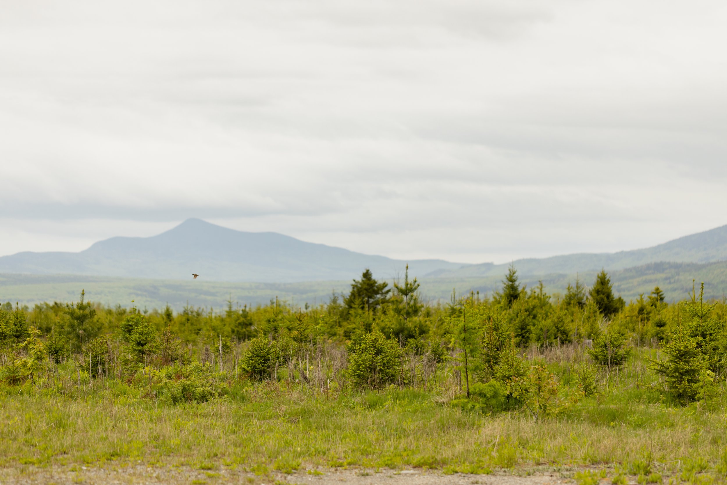
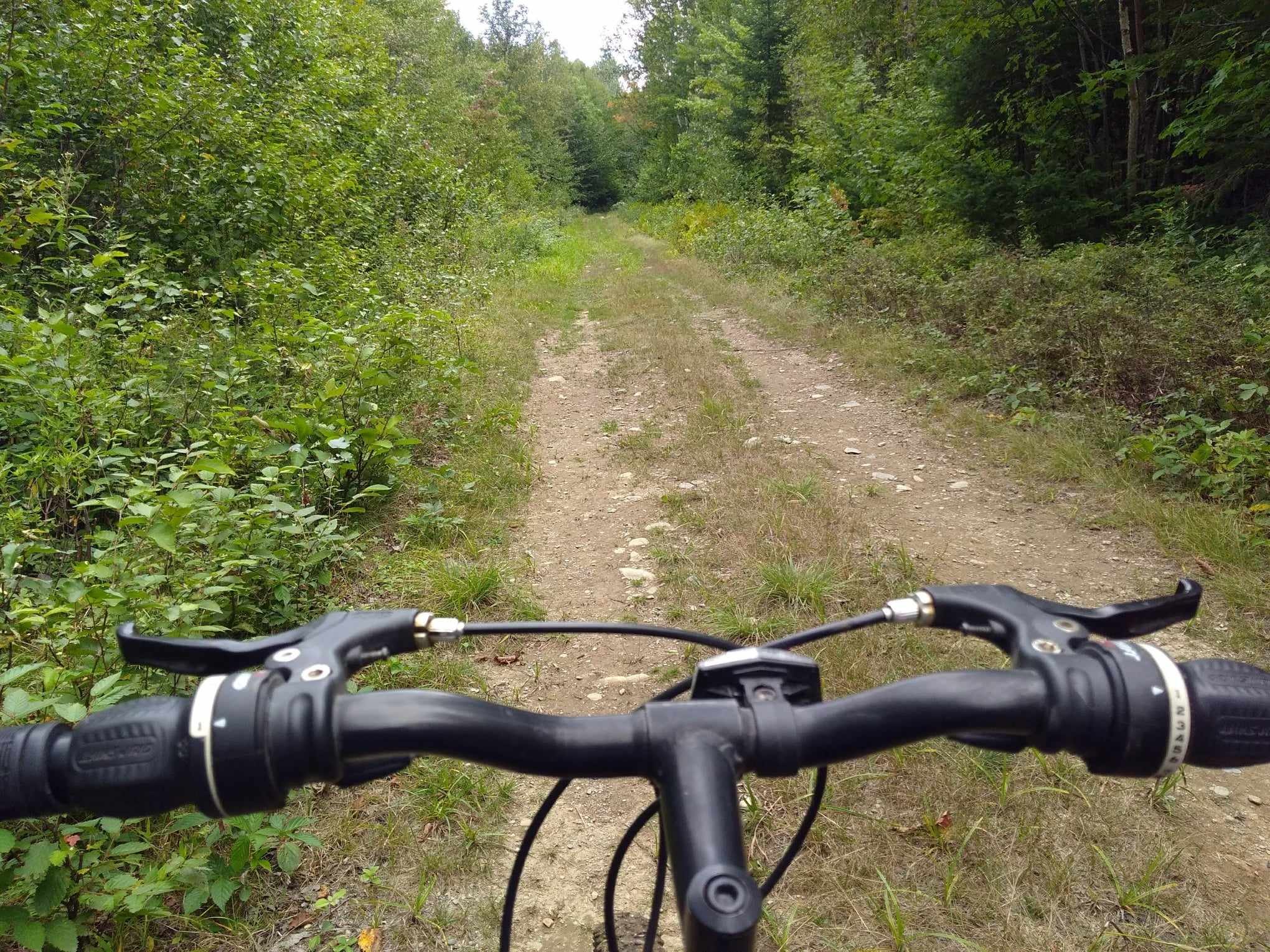
Biking in our region is the perfect way to enjoy some of Maine's most scenic beauty. During fall, the colors will surely take your breath away. While we do not currently have any trails specifically for biking, we have hundreds of miles of dirt roads and ATV trails suitable for many types of biking. Please be mindful of other drivers and use caution when riding.
Hiking


Moxie Falls – Easy Walk – 1.0 Miles
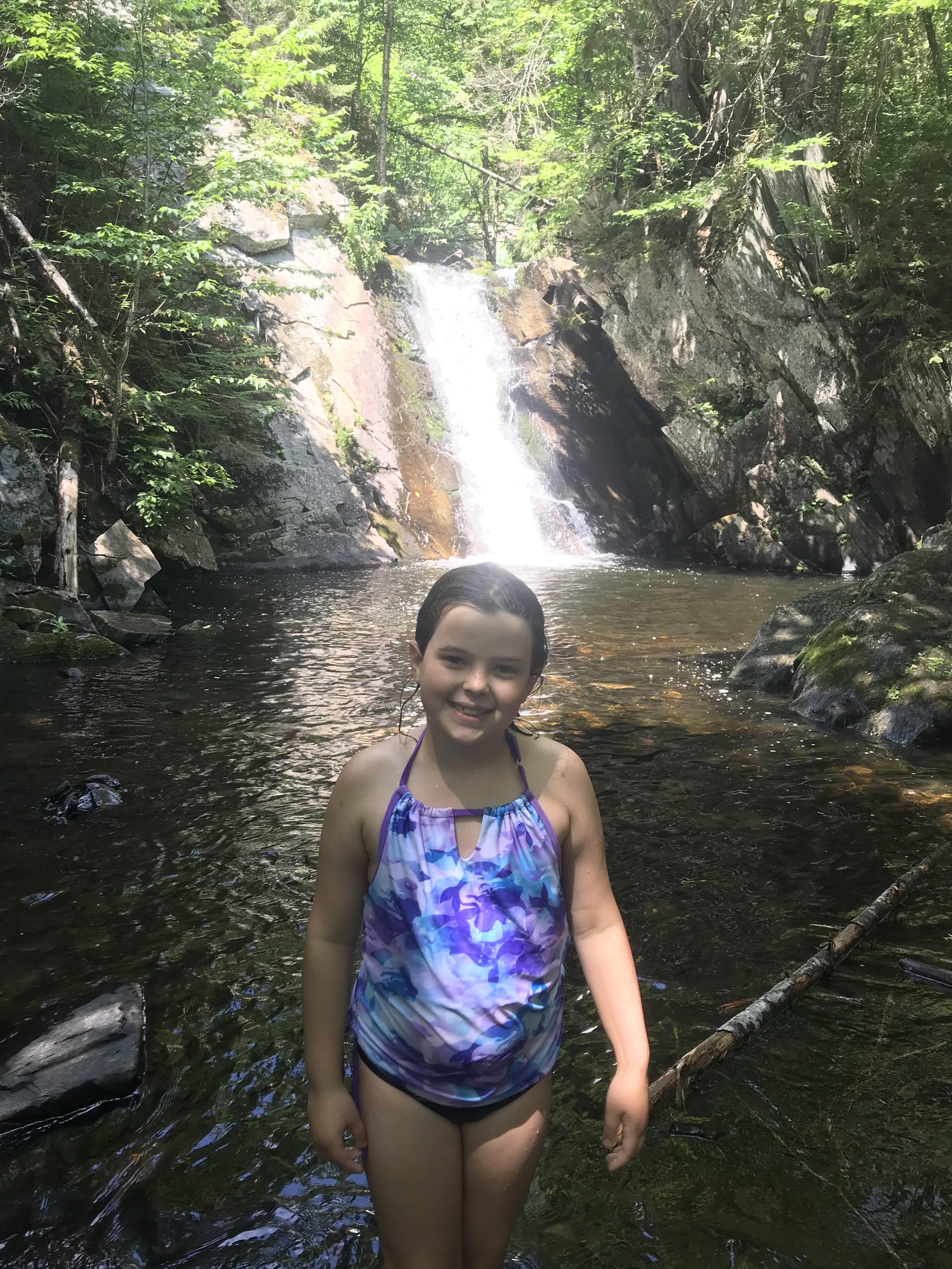
This 90-foot cascade, which is fed by Moxie Stream, is said to be the tallest “known" continuous waterfall in all of Maine. It’s a very popular site among visitors to the area too. After plummeting over stepped rapids above, the waters of Moxie Stream plunge 90-feet through a narrow gorge. From here, Moxie Stream flows right into the Kennebec River. The word “Moxie" is thought to have come from an old Abenaki Indian word meaning “dark water.” The falls were used as part of the yearly Kennebec River logging drives prior to their end in 1976. Huge logs were dropped over the large waterfall and into the Kennebec. In 1994 a portion of the Disney movie “Iron Will" was actually filmed at the falls.
The access trail into Moxie Falls is very well maintained. The falls can be reached easily in 20-30 minutes. There are stairs located around all the steep areas within the gorge, and observations decks have been built as well along the rim of the gorge close to the falls. There are a few different swimming holes located a points just above the falls. For the more adventurous, it is possible to hike down and swim or fish in the water below the falls.
Directions: Follow Route 201 south to the town of The Forks. After crossing The Kennebec River, turn left onto Lake Moxie Road and follow it for approximately 1 mile. Look for the signs for Moxie Falls and its parking area on the left. Follow the signs to the trail head.
Cold Stream Falls – Easy Walk – 1.0 Miles
It’s a short ride down Rt. 201 to Capital Road then a short hike to the falls. Cold Stream Falls is a 20’ waterfall that is fed by Cold Stream and definitely lives up to its name. This water will cool you off! There is a nice large swimming hole at the base of the falls with two levels of rock ledge to jump from for the more adventurous. The hike itself is mostly flat and well marked with blue markers. There is a sign at the trailhead which is located along ITS 87 and is an easy drive to get to.
Directions: Follow Route 201 south about 6 miles to Capital Road on the left. Cross over a bridge at 0.9 miles then soon after turn left onto Mountain Brook Rd. The road splits as soon as you turn onto it but you can take either path which soon becomes Snowmobile ITS 87. The road has a few bumps and rocks but passable by most all vehicles. Travel about 2 miles and the trailhead will be on your left, along a corner of ITS 87 with an open grassy parking area.
Williams Mountain - Moderate - 1.5 Miles
Nearby Williams Mtn. straddles the town lines of Misery Township and Parlin Pond Township. A steel fire tower, erected in 1914, still stands on the Williams summit, as does the old fire warden's cabin, which is in surprisingly good condition. A 1.5-mile blue blazed trail, constructed by the Maine Bureau of Parks and Lands in 2017, offers a gradual climb over the mountain's northeast ridgeline.
Directions: Take Rt. 201 north to Parlin Mountain Road. Cross the bridge over Parlin Stream and bear left at the fork just after the bridge. After a few miles turn left onto Smith Pond Road and proceed a few more miles past Smith Pond. Trailhead will be on the right about a half mile past Smith Pond.
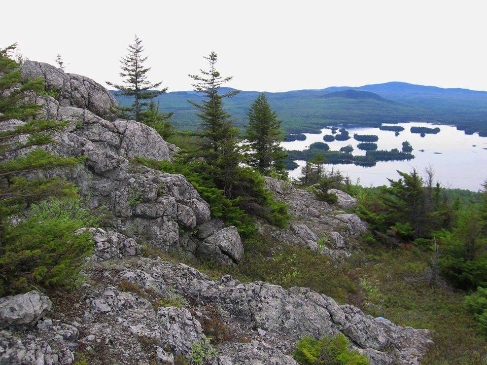
Number Five Mountain - Moderate - 3 Miles
Number Five Mountain is in the heart of the Leuthold Forest Preserve, just southwest of the Parlin area. The 16,934-acre chunk of forestland is owned by The Nature Conservancy and abuts a 50,000-acre swath of other public and private conservation lands. The 1933 fire tower still stands on the open summit ledges, reached via a 3-mile hike on the old fire warden's trail. The 360-degree vista is extraordinary. The trailhead is a 17-mile drive on the Spencer Road from Route 201 at Parlin Pond. The Spencer POW Camp Memorial is a must-see on the drive in.
Grand Falls – Driving and Snowmobile Access – Easy Walk – 0.5 Miles
Grand Falls is an amazing waterfall unknown to many. The falls are just upstream from the rafting put-in for all whitewater trips on the Dead River – but you can’t see anything from your raft by looking upstream. The Grand Falls just happen to be “hiding" around a corner out of view!
Just upstream of the falls is one of the huts that make up the Maine Huts & Trails System. The “Grand Falls Hut", and others like it, are one of four currently in-place throughout the western Maine Mountains. This system of trails and huts is growing constantly. So, for more information on the Maine Hut and Trail system, please visit their website at; http://www.mainehuts.org/.
Grand Falls is also right along Maine’s ITS 89 snowmobile trail – so it’s now as popular a destination in the winter as in the summer. In the summer, you can also drive to the falls and see them with minimal walking.
Directions: Go south on Route 201 11.4 miles and turn right onto The Lower Enchanted Road; a dirt logging road. Follow the Lower Enchanted Road to mile 4.7 where the road splits. Stay to the left-split on The Lower Enchanted Road. Continue straight past through intersections and bearing to the left in places wherever the road splits. At approximately mile 14 there is a large clearing and a small kiosk building. Pass the kiosk for a short distance and you will reach The Dead River. At the bottom of the hill you can park your car, and walk across the metal bridge over a stream that empties into The Dead River. Follow the obvious trail along the banks of The Dead River for only a few hundred yards to an overlook of Grand Falls.
CAUTION: Logging trucks have the right of way on these dirt roads. They are owned by private lumber companies who must allow public access, but travelers still must yield to ALL logging traffic.
Slide Down Falls - Moderate - 2.1 miles round trip
Slide Down Falls is a beautiful series of waterfalls in the Jackman Moose River Region. The Falls are on the west branch of Sandy Steam. The hike is relatively short, but the second half is steep, .35 miles to the falls. The hike to the falls is 1.05 miles, .7 are on the Dumas Road. This hike is a local favorite and when you reach this little piece of Heaven you will completely understand why!
Directions: Travel North on Route 201 for approximately 8 miles from the Moose River Bridge. On the left side of the road in the South Dumas Road. Follow the road until you reach the yellow gate, approximately 1 mile. There is a small parking area where you will be able to park and start your hike. Walk around the gate and follow the Dumas Road, the road splits into 3, take the middle route, the Dumas Road. Follow the Dumas road for .7 miles until you reach the trailhead on the left. Watch a video of this hiking experience, here.
Owls Head Mountain - Short but steep - .7 miles round trip
If you are looking for a short hike, look no further than Owls Head Mountain. The hike is located at the Attean Overlook Rest Area, just south of Jackman. The trail head is on the left, if you are looking at the trees and not the beautiful view of Attean. The hike is .7 miles round trip and relatively steep, but the view is spectacular!
Directions: The trailhead for the hike is located at the Scenic Overlook Rest Area South of Jackman. The rest area is about 4.25 miles south on Route 201 from the intersection in Jackman with Route 15/6. The trail can be located at the left side, facing the mountain next to a covered picnic table. There is a sign letting hikers know that the trail is maintained by the local Boy Scouts. Watch a video of this hiking experience, here.
Burnt Jacket Mountain - Moderate challenge - 1.5 miles
This mountain is visible from US 201 when approaching Jackman, a clumsily shaped ridge is located just six miles south east of the Canadian Border. The hiking trail leads to open summits from which there are dramatic views of the Moose River Valley
Directions: From the bridge over Moose River, continue on Route 201 for one mile. Turn left onto Sandy Stream Road and go .3 miles to a fork. Bear left on Gander Brook Road and continue 4.3 miles to a gated bridge over Wood Stream. Park on the right. Walk across the bridge and through the gate. In 200 feet, you’ll see a grassy track to your right, headed up a hill. Follow this almost to the crest of the hill, and you’ll see the tagged footpath to your left. Watch a video experience of this hike, here.
Sally Mountain - Moderate challenge - 4.8 miles
Captain Samuel Holden, the first to call this remote region home in 1820, looked out over the quiet waters of Wood Pond at an unnamed mountain. One day, he took his young daughter's hand, looked into her eyes and said, "That's your mountain now. That's Sally Mountain" Blueberries flourish up here during late July to early September so you'd better pack an appetite.
Directions: Reaching the base of Sally Mountain involves canoeing or kayaking across Attean Pond to the trail that is located on Sally Beach. You will cross an active set of train tracks to reach the trailhead, please use caution. Having the map downloaded ahead of time is helpful for locating the spur trail that climbs up the mountain. There is a tree with a blue marker on it designating the beginning of this trail.
Boundary Bald Mountain - Strenuous challenge - 2.6 miles
The hiking trail was built in 1911 and used to reach the wooden fire tower. Now a radio repeater station sits in its place on the open summit. (3,640 feet)
Directions: From the bridge in Jackman over the Moose River, go just about 8 miles to Bald Mountain Road. After you turn onto Bald Mountain Road, pass through the gate and drive roughly 4.5 miles on a gravel road. When the road splits around mile 4, go left for another quarter mile on Notch Road. When you get to the next junction, turn left to park in the grassy cleared area on the left. There will be a gated road to your left, and Trail Road, to the trailhead, continues straight, up the hill.
Coburn Mountain - Strenuous challenge - 3,718 feet
Tallest of all mountains between the Bigilow range to the South and the peaks of Baxter State Park; It is nicknamed Enchanted Mountain. Your vehicle needs to have good clearance to get to the trail. The 24 foot steel fire tower on Coburn was built in 1914 but was crushed in 1938 by ice. Abandoned until 1966, rebuilt, and in 1968, high winds blew off the cap. In 1999 it was repaired and the platform is now sturdy enough to stand on while you take in the views.
Directions: The trailhead is off Enchanted Mountain Road, which extends west from Route 201. From the intersection of Route 201 and 15 in Jackman, the intersection of Route 201 and Enchanted Mountain Road is 14.3 miles south. Once you’re on Enchanted Mountain Road, go 2.1 miles on a passable but rough gravel road (stay right when the road splits early on). You’ll come to the old ski mountain base, where you can park. When you arrive at the mountain base, (park in this large clearing), walk .2 miles on the road headed off to your right, if you’re facing the mountain, and when the road makes a sharp turn to the right, you’ll see a rocky snowmobile trail headed steeply up straight in front of you. There is no trail sign.